
Diver Gun Strip Site T18

Finally got round to recording Diver Battery T18 today. Not much remains - just a few concrete bases for huts and perhaps three out of the four gun pits. T18 was a HAA battery, i.e. 4 x 3.7" guns. 


 Above: 1945 aerial of T18 - the huts can still be clearly seen. 

I could only find the remains of four concrete bases for the huts, although others may still remain buried under the leaf litter or covered over by gorse scrub.


Above: Remains of a concrete base for a hut.

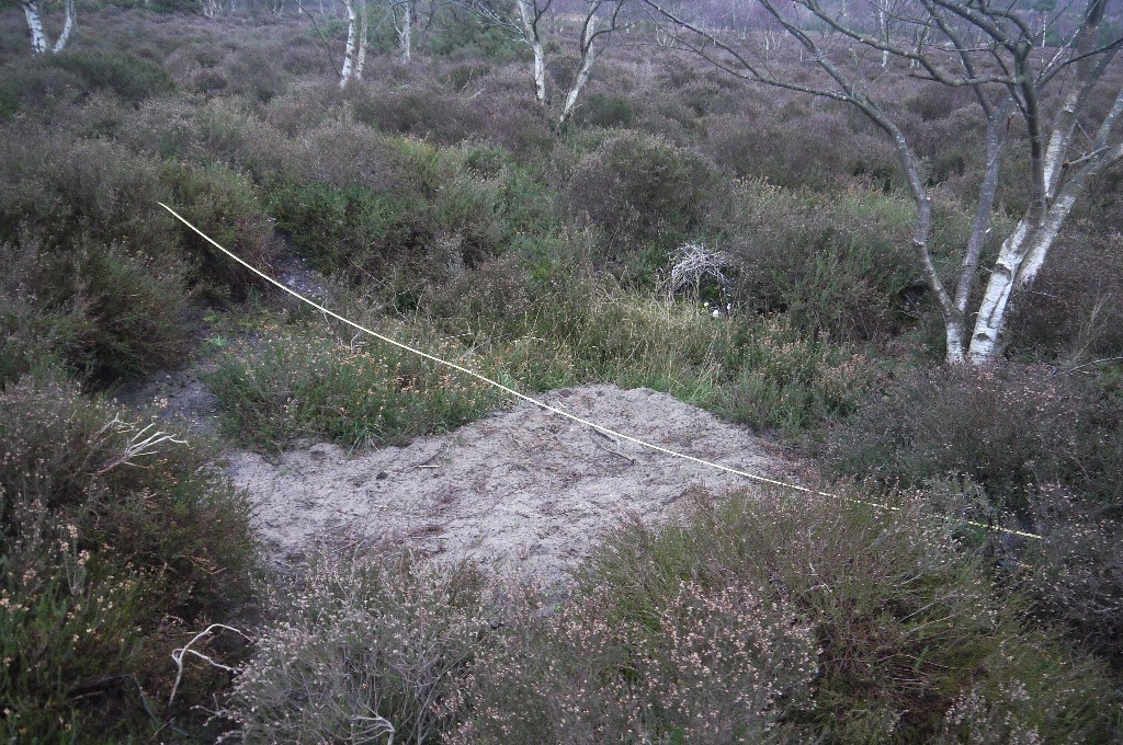
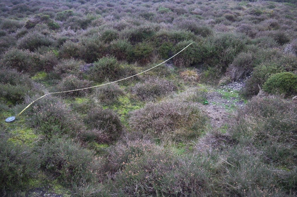
Something I had not picked up before on my previous visits to this site was that the course of the Sommerfield track laid around the perimeter of the site can still be followed in places.  Sommerfield track consisted of 2 inch or three inch mesh netting reinforced with 3/4 inch mild steel rods at 8 inch centers. The track is joined longitudinally by buckles and transversely by linking bars held down by special angle iron pickets. It was supplied in rolls 25 yards long by 10ft 7ins wide. 


Above: Top image clearly shows where Sommerfield track was once laid. Note the circled angle iron picket used to hold down the track.
Middle two images shows a pile of the angle iron pickets used to hold down Sommerfield track.
The second image shows the  group of pickets a couple of years back when the ground was much more open (following some heathland restoration work). 
Bottom image shows Sommerfield track being laid for it's original intended purpose - a temporary runway for an airfield. Note the angle iron pickets. 

The gun pits provide a bit of a problem. Although they match the dimensions and spacing you would expect for the depression in which a Pile mattress would have been constructed to mount the guns on, they are not orientated in the direction you would expect given the Bonzo engagement arc for this battery was 30 deg to 170 deg (Bonzo was the code word for  proximity fused shells). The guns should be placed at right angles to a line bisecting the Bonzo engagement arc i.e. aligned along a line  10 deg to 190 deg. Despite much searching there was no sign of a fourth pit. 


Above: GPS data calibrated onto the aerial photo of the battery. The remains of the four huts are shown in black, the course of the Sommerfield track in red and the three possible gun pits are the red circles. They are clearly no where near aligned along the line 10 deg to 190 deg. (Remember the layout for Diver guns was an inverted bow - see main website).


Above: An image of each of the three pits. The diameter of the pits was approx 18-21 ft i.e. what you would expect for a pile mattress. 


Comments

Popular posts from this blog

Eastern Command Line - a lazy post

As the title suggests, just a lazy post today, a few pics of CRE Colchester design pillboxes in the Sudbury area to round of the thread on this May visit. Also one pic of concrete road block cylinders now being used as part of river bank defences. This is the first time I have come across this type of road block in Suffolk although I suspect it was probably used quite widely on this Stop Line, perhaps I will come across more examples / references in time. These pictures do show a timeless landscape - traditional floodplain meadows still used for grazing, with the Second World War clearly marking its presence. Lets just hope both the pillboxes and  grazing meadows will be preserved.

RAF Hethel Defence Post

At RAF Station Hethel, a remarkable defence post still exists.  Admittedly, RAF Hethel is in Norfolk and not Suffolk, but the records for this site do provide some interest in relation to the defence of airfields in Eastern Command. Work on Hethel began in 1941 and the station was opened late 1942 and was actually one of the RAF Stations handed over to the USAAF for the use of its bomber units. The defence post was constructed in accordance with a new policy adopted by Eastern Command. Previously, airfield defences had been built as a result of the Taylor Report and largely consisted of pillboxes and breastworks which were large and conspicuous and vulnerable to air attack. Experience at Crete had shown the need for small inconspicuous field works. The new defences were to now consist of small two man weapon-slits and small machine gun pits constructed in accordance with “Infantry Training, 1937” Supplement No.3 – “The design and lay-out of Field Defences, 1942”. Above...

Anti-tank ditch

December 31st Decided to visit the anti-tank ditch at Aldringham Walks this afternoon. It was constructed between late 1940 and early 1941 and ran from (north to south) Sizewell to the north of Thorpeness Mere. Some of its length is still visible today (see map and bottom photo)). The war diary of 9th Cameronians (15th Div) mentions the construction of the ditch in Margaret Wood (vicinity of No 12 Platoon, B Coy).  The diary also mentions a pillbox being destroyed by the RE in No 12 platoons area, but no luck in finding any remains this time. The diary would also indicate the ditch was a combined obstacle with Z1 scaffolding. The top left photo shows the remains of a weapons pit/shell slit; six pieces of angle iron revetment still exist - one of the pieces is clearly visible in the photo. Perhaps this is part of No 12 platoons position. Many years ago when beating up the young woodland I found a Yorkshire billhook with the WO arrow dated 1946, so this area would appear to have ...