The first of a few posts on the Corps Line. This ran from River Orwell to Ipswich - hence River Gipping to Haughley - hence approx Tostock - hence river line to junction with Little Ouse NW of Euston.
This Stop Line is often referred to the east arm of the Eastern Command Line, however I have found no reference to this in files at TNA so will refer to it as the Corps Line as the documents I've seen do so.
Of the Stop Lines in Suffolk the Command Line and the Corps Line were the only ones planned to be developed into defensive lines with priority being given to the Command Line. As work was more or less halted on inland Stop Lines in Sept / Oct 1940 the Corps Line was probably never developed as planned. It is certainly much weaker than the Command Line with 'bullet proof' Type 22 and 24 pillboxes only which were also much less densely sited than on the Command line. The Corps Line would also seem never to have reached the stage of development in depth as on the Command Line.
Below: The Corps Line from Elmswell to Ixworth.

Below: The Corps Line from Elmswell to Ixworth.

This post will look at some of the remaining defences in the area Elmswell to (excl) Stowlangtoft with Part 2 looking at Stowlangtoft to Ixworth. The railway line between Haughley to Elmswell appears to be the planned anti-tank obstacle but between Elmswell and Stowlangtoft the pillboxes seem sited to cover the A1088 rather than any anti-tank obstacle - it is likely that this stage of construction of the Stop Line (i.e a continuous anti-tank obstacle) was never completed.
The fist set of photos show standard anti-tank 'pimples' blocking a crossing over the rail line. In the third photo two larger blocks can be seen which would have taken a metal rail to block the actual crossing point. Just to the west of the block is a bullet proof Type 24 pillbox.


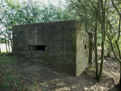
The next pillbox is just to the south of Norton again a bullet proof Type 24..


The fist set of photos show standard anti-tank 'pimples' blocking a crossing over the rail line. In the third photo two larger blocks can be seen which would have taken a metal rail to block the actual crossing point. Just to the west of the block is a bullet proof Type 24 pillbox.


The next pillbox is just to the south of Norton again a bullet proof Type 24..


The pillbox at Stanton Steeet has been partially demolished probably during the War as part of training. The Corrugated Iron sheet used for shuttering the roof is clearly visible along with the reinforcement rods used in the roof. All of the pillboxes in this area have been constructed with wood external shuttering and internal brick shuttering - which can be seen in the images below.


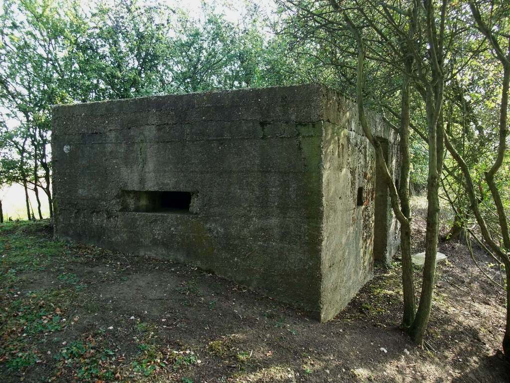
The photo below is of the pillbox just north of Stanton Street.

Comments
Post a Comment