We spent an interesting day looking at a couple of areas of the Arras 1917 battles. First area was a walk around the northern side of Monchy le Preux. This walk covered the area Happy Valley – Lonely Copse-Rifle Trench, an area of fierce fighting as the Battle of Arras dragged on after its initial success.

The 17th Northern Division attacked in this area on April 23rd 1917. The attack made only limited gains, with uncut wire and heavy enfilade machine gun fire from the north side of the Scarpe being responsible for the failure. A further attack was made on April 25th and a lodgement in Rifle Trench was made.
We started from Monchy le preux, walking to Orange Trench Cemetery then to Happy Valley cemetery.


From Happy Valley we walked up to Lonely Copse, which still showed the scares of the Battle of Arras. It was used as an assembly area for the attacks made by the 17th Northern Division.

We then crossed the fields where Bayonet and Rifle Trench were situated and then back round to Monchy.


The 17th Northern Division attacked in this area on April 23rd 1917. The attack made only limited gains, with uncut wire and heavy enfilade machine gun fire from the north side of the Scarpe being responsible for the failure. A further attack was made on April 25th and a lodgement in Rifle Trench was made.
We started from Monchy le preux, walking to Orange Trench Cemetery then to Happy Valley cemetery.
Above: 1st image - 37th Div Memorial, Monchy le Preux
2nd image - Caribou built on top of a concrete observation post, Monchy le Preux
3rd and 4th image - Orange Trench Cemetery
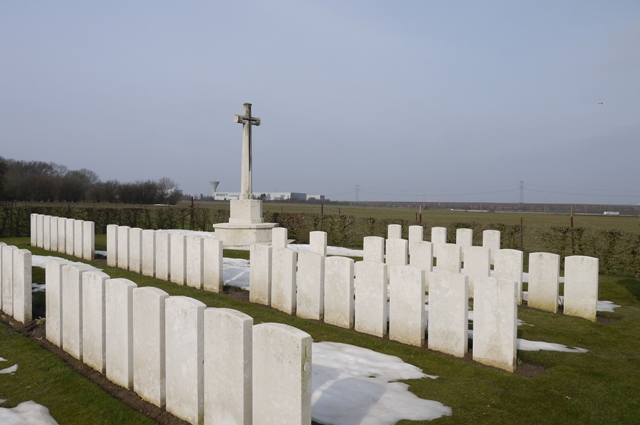
5th image - Happy valley Cemetery
6th Image - possible collapsing dugout, Happy Valley
7th image - Happy Valley and Cemetery, the slope rising up to Orange Hill
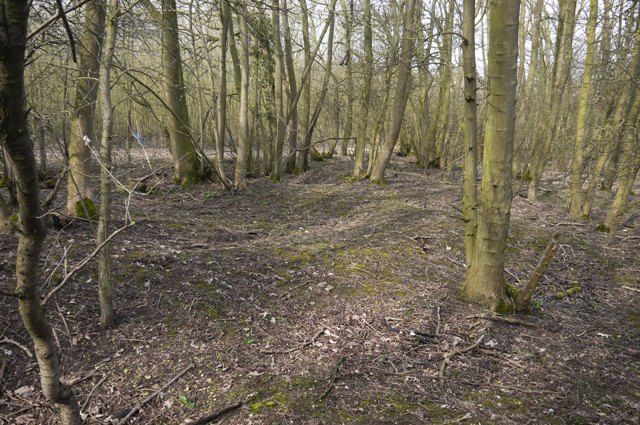
From Happy Valley we walked up to Lonely Copse, which still showed the scares of the Battle of Arras. It was used as an assembly area for the attacks made by the 17th Northern Division.
Above: Lonely Copse, top image shows remains of Dragon Trench. The Copse was used for Assembly trenches by the British for attacks on Bayonet and Rifle Trench.
We then crossed the fields where Bayonet and Rifle Trench were situated and then back round to Monchy.
Above: top - unexploded shell in foreground, overlooking the area of Bayonet and Rifle Trench
Middle - collapsing dugout, Bomb Trench
Bottom - screw pickets, Arrow Head Copse
Next post will cover Observation Ridge, one of the best walks I've done in recent years, although with the continued expansion of industrial Arras how much longer it will remain as an open landscape is open to question!
Comments
Post a Comment