Following on from my last post on H2 - HAA emplacement, Trimley, I also visited the site of the GCI (Ground Controlled Interceptor) Radar site at Trimley on the same day. I must admit I do not know that much about WW2 Radar so most of the details for this post come from Wickidpedia.
Chain Home Radar sites only picked up raiders as they came in over the sea. Once they had crossed the British Coast, tracking was entirely reliant on the Observer Corps. To improve on this situation, the RAF established a network of 'Ground Controlled Interceptor' Radar stations. These stations were able to direct search lights onto enemy raiders but more importantly vector night fighters to a close proximity of the raiders so they could be engaged. GCI was up and running from 1941 but I think the Trimley site was only operational from early 1943.
I presume the remains at Trimley toady are of the the main operational building plus some of the domestic huts.
One more post on the Trimley visit to come - as far as I know a unique 'Suffolk Square' Pillbox in that it has an AA well attached much the same as a Type 23 Pillbox.
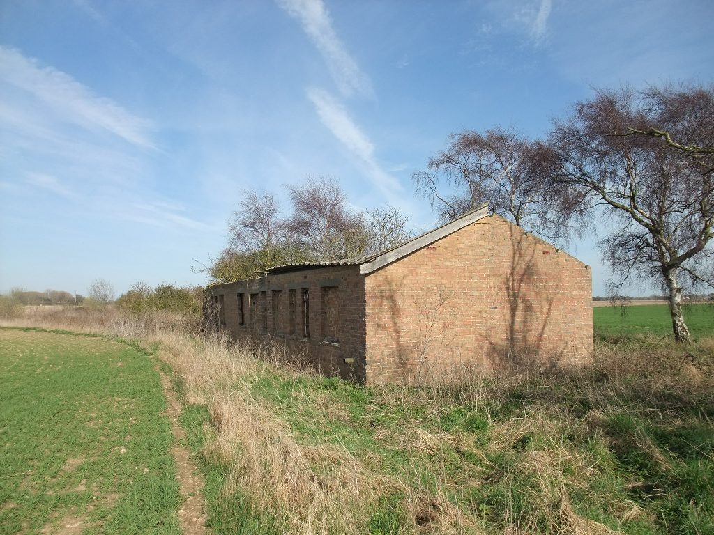
Images 1- 11: Presumably the main Operations Building
Images 12-17: Remains of the Domestic site
Image 18: large concrete rubble remains
Image 19: Remains of the wire defence - barbed wire and screw pickets


Hi there,
ReplyDeletehave seen your website and your excellent photos of RAF Trimley Heath. I have been putting together a website (www.rotorplanuk.co.uk) for the last 18 months detailing the ROTOR air defence project that was in existence during the 1950s, and would interested in using some of your images of the Trimley Heath on the website.
My own interest in the subject stems from 30 years in the RAF as a Radar Operator, the vast amount of my time in the Service was spent underground in former ROTOR bunkers. If given permission the images I use will contain the details of the source and a link. The website is not a commercial venture as it was conceived as a dedication to all the personnel who were involved in the ROTOR project, and I hope it will be a testament to the sacrifice those personnel made during the dark days of the cold war.
If you could see your way to granting permission for me to use this information it would be greatly appreciated. . If you have any further questions please do not hesitate to contact me.
Kind Regards Kev Lloyd-Jones
Hi Kev,
DeletePlease feel free to use the images,
Kind Regards
Dave
The main building that you can see at RAF Trimley Heath is the generator block. The main Operations were situated in a 'Happidrome', now demolished, but thought to have been situated in the ploughed area to the left of the remaining buildings. In the late 1940's operators at RAF Trimley Heath tracked a UFO, that travelled in excess of 1000mph. At that time, the fastest jets could only do around 700mph. There are several reports, by trustworthy people, of this incident.
ReplyDeleteMy grandmother served there during the second world war which lead me to look this location up. I could see little from the road as it is a high speed section of dual carriage way. My grandmother told me that they had to run from the staff vehicles to the bunker entrance under fire from German aircraft.
ReplyDelete